Trip Mapper
CPollreis/trip-mapperA trip planner that reads one JSON file and generates a day-coded map, a full itinerary, a booking checklist, and a Google My Maps import, with a live-reloading local UI for planning against the map as you edit.
What it does
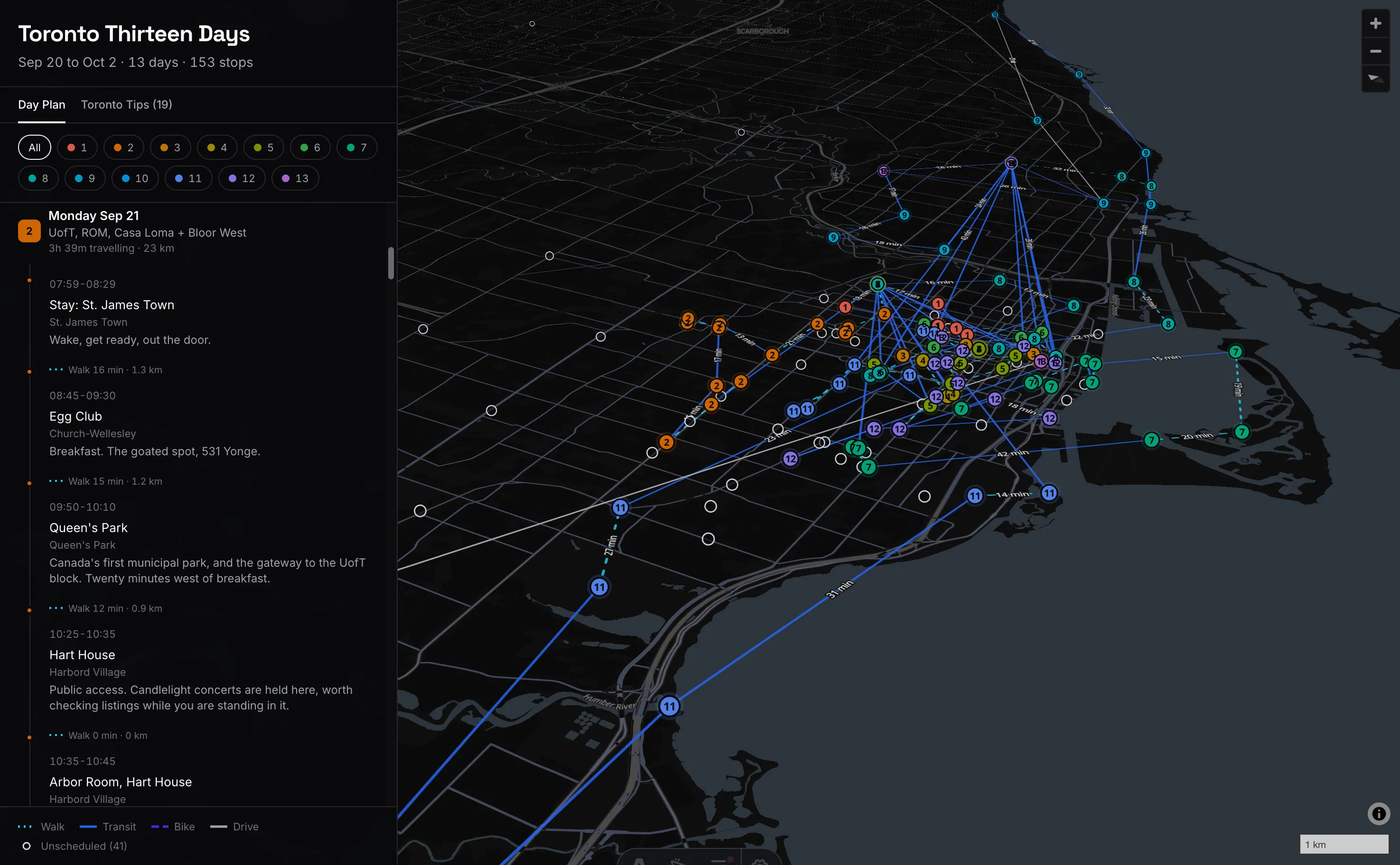
Trip Mapper turns one JSON file into a full trip: a day-coded map, a readable itinerary, a booking checklist, and a Google My Maps import, all generated from the same source. Editing the trip file and watching the map redraw live is the whole workflow: no separate planning app, no manually re-pinning a map every time an afternoon changes.
A trip file is two arrays. places[] is the what, a venue with its
coordinates, listed once. days[].items[] is the when, a time slot that
points at a place. Splitting them means a spot you visit twice only needs one
set of coordinates. Every place also carries a source.confidence: confirmed
when a caption or location tag names the venue outright, inferred when it’s
worked out from context and then verified, unresolved when a source is real
but nothing could be pinned, in which case it stays off the map entirely and
drops into a generated unresolved.md instead of silently guessing.
How it’s built
The renderer is Astro + React with MapLibre GL for the map, TypeScript
for the schema, validation, and route logic underneath it. npm run dev
builds, serves, and live-reloads: edit the trip file in one window, watch the
pins and routes redraw in the other.
Routing is honest about what it can’t measure. The only free routing service with a hosted “walking” and “cycling” profile silently substitutes car routing for both, so its durations are useless for anything but driving. What it does give honestly is road distance, which beats a straight line by a wide margin. So every non-driving leg takes that road distance and applies a mode-specific speed (walk, transit, bike each get their own km/h and a fixed overhead), while driving keeps the routed duration outright.
The 13-day color ramp is computed in OKLCH, not HSL, so each day reads as a perceptually even step from warm at arrival to cool at departure rather than a ramp where the yellows glare and the blues go muddy.
Validation runs as a pure pass over the trip file: duplicate place ids,
unknown placeId references, malformed times, overlapping items on the same
day, out-of-chronological-order items, and places that fall outside the
destination city’s bounds (or, with no bounds file, that sit implausibly far
from the rest of the trip) all surface as errors or warnings before anything
renders.
Personal data has its own enforcement, not just convention. A gitignored
resources/private.json overlays real addresses and exact coordinates onto
the committed trip file at build time. On top of that, scripts/scan-personal.mjs
scans every tracked file (and, separately, commit messages) for emails, phone
numbers, booking/confirmation codes, and card numbers, the last checked with
an actual Luhn pass so a real card fails closed instead of a false-positive
digit string. It redacts what it finds by default and only prints the matched
text with --show, since the repo, and therefore its CI logs, is public.
Future improvements
COMING SOON